You won’t run out of things to do in Yosemite, and that’s one of the reasons why so many people visit it each year. Hiking across its 750 miles of Yosemite trails and more than 700,000 acres of wilderness means that you can take numerous trips without having to repeat the path you’ve already taken.
You should just start first with the best backpacking in Yosemite so that you’re always itching to go back for more. You’ll also need a Yosemite trail map, and that at least gives you the most convenient trails from your Yosemite entrances. You may want to wait until spring, which is the best time to go to Yosemite.
You can enjoy various views, such as when you go on a Yosemite Falls hike and find the highest waterfall in the park after traversing the Yosemite Falls trail. Or maybe you can go on the Panorama Trail, from Glacier Point to Yosemite Valley.
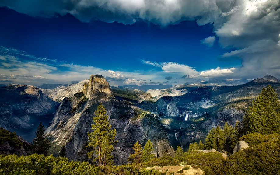
You can try the Upper Yosemite Falls hike, but this is very strenuous. A much easier option is to hike Water Wheel Falls. Maybe you can just stay at Crane Flat Yosemite, with the other campers. If you want to hike from there, it’s only 17 miles to Yosemite Valley.
So when you look at a map of Yosemite National Park, which trail should you pick? Some of the easier options are Yosemite day hikes, when you try out a four mile trail Yosemite beginners tend to go for.
Others are so grueling they go for almost 90 miles and demand serious skills. So while you may truly enjoy the sight of shining alpine lakes, cascading waterfalls, flowing creeks, spiky skylines, and spiraling granite peaks, you still shouldn’t overestimate your hiking ability.
So pick one of these options that match your hiking skills and experience:
The Most Popular of the Yosemite Hiking Trails: Happy Isles Trailhead in Yosemite Valley to Half Dome, Clouds Rest, and Sunrise
Ask around the vets in the area, and many will say that this is the most popular backpacking hike in Yosemite. The starting point is Happy Isles, and this too is the most popular trailhead. The hike also gives you a night to spend in Little Yosemite Valley, which is the most popular among the best Yosemite campgrounds.
This particular hike goes for 37.2 miles, so it’s not really something that newbies should tackle on their first try. It goes through the very heart of the park, and it includes the Most Trail that lets you see the 594-foot Nevada Fall and the 317-foot Vernal Fall.
We think you'll like: Top Yosemite Camping Tips for Newbies | Prepare Yourself for This Awesome Adventure
You go via the cable route up to Half Dome, and you’ll get a view of the terrific Clouds Rest summit. It also goes through a part of the John Muir Trail, and from your camp at Sunrise you’ll get a fantastic view of the Cathedral Range.
Yosemite Backpacking from Rafferty Creek Trailhead to the Sunrise Lakes Trailhead
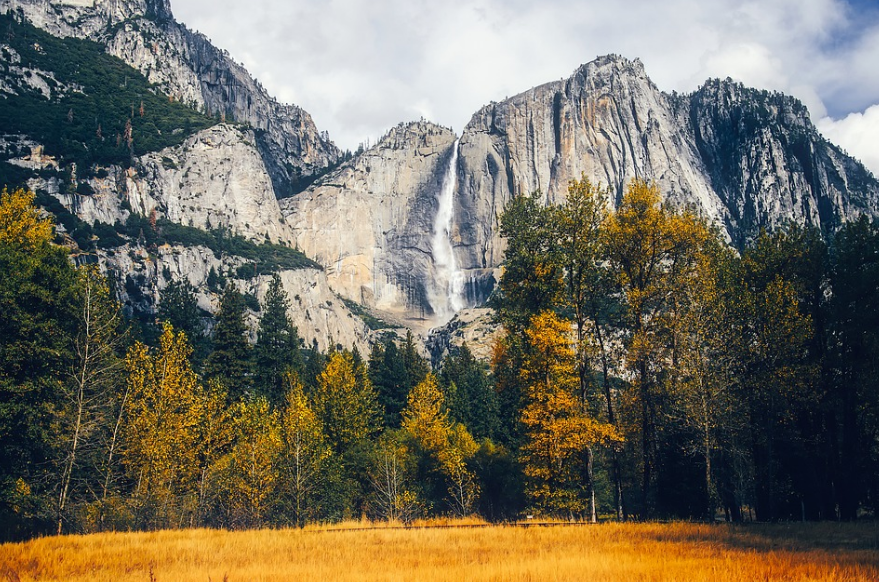
This hike lasts about 30 miles. It starts from the Rafferty Creek Trailhead located at the eastern end of Tuolumne Meadows. It ends at the Sunrise Lakes Trailhead at Tenaya Lake. The start and the end of the hike offer amazing vistas that beg for endless picture-taking, but they’re not the only attractions of this hike.
As you go along the trail, you’ll enjoy the breathtaking panorama of the mountains from Vogelsang Pass. You’ll be awed by the gorgeous canyon of the Merced River.
You’ll love the view of the Cathedral Range from Sunrise. Even the comparatively quiet parts of trail have their own charms.
Vogelsang, Merced Lake, and Sunrise make up 3 of the High Sierra Camps. Here you may want to take a load off and stay in a tent cabin and your meals can even be prepared for you. There are also backpacker campgrounds if you’re determinedly in DIY mode.
If you're going with your family or a larger company, consider taking a big tent for several people.
Hurry to reserve a permit for this hike, as it’s quite popular. It’s actually quite accessible, the scenery is fantastic, and you have convenient free shuttle buses operating between the trailheads throughout the Tuolumne part of the park.
The Clark Range and Southeast Yosemite
This hike south of Tuolumne Meadows goes for 65 miles, so you better be ready to hike. Many consider this the best hike for the backpackers who want a remote wilderness trip but who also want to include iconic landmarks.
Here you’ll encounter the roaring Nevada Fall that goes up 594 feet. It also has 2 of the best summits in the whole of Yosemite, and one of them is Half Dome high above Yosemite Valley where you can find Half Dome village. The other one is Clouds Rest, where in any direction you have a terrific view of most of the park. Not surprising, really, since you’re almost 10,000 feet up.
In places such as Tuolumne and Vogelsang, you’ll get to see granite domes and peaks. The trail crosses the Red Peak Pass in the Clark Range, and this is the highest pass reached by a trail in Yosemite. It also gets you across the headwaters of the Merced River, where you’ll have great panoramas of granite basins and tarns, lakes, and creeks.
The Grand Canyon of the Tuolumne River
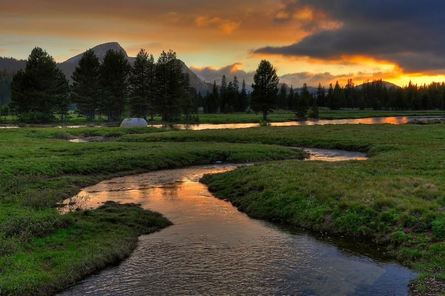
This is like Yosemite Valley except it’s twice as long and it has more of the wilderness. You don’t see cars, roads, or buildings anywhere and there are very few (if any) people about.
As you go along the Tuolumne River, you’ll encounter numerous waterfalls and soaring walls of granite with swimming holes in between them. The trail sometimes follows the river, and at other times it goes high above it.
You can use the shuttle between the trailheads so that the canyon hike can last only 3 or 4 days. It will be about 30 miles long starting from Tuolumne Meadows through Glen Aulin to White Wolf west of Tenaya Lake. Of course, you can choose to go from the White Wolf campground to Tuolumne Meadows.
One alternative is to go down hiking from Tuolumne Meadows and go as far down as you like. Once you’re into the canyon deep enough, you can always just go back. Logistically, this isn’t really the easier option but you can backpack a bit down the Grand Canyon of the Tuolumne. You can then get one of the fine campsites available for 2 nights, and then you can go even farther down the canyon with just a light pack.
So let’s say you start from Tuolumne Meadows and you get to Pate Valley. This is at the southern end of the Grand Canyon of the Tuolumne River. You can then go back the same way, and you end up with a 39-mile jaunt.
Northern Yosemite
This hike will most likely offer the longest stretches of isolation you’ll ever find hiking in Yosemite. It’s a winding trail north of Tuolumne Meadows, and you go across Yosemite’s loneliest areas. You’ll find the remotest parts of the wilderness here and the biggest too.
So you better know if you’re ready to go hiking as deeply as any hiker can explore into the backcountry of Yosemite. This surely isn’t for newbies, as the hike goes on for 87-miles. You really should not hike alone though, as the extended stretches of isolation won’t get you any help if you get in trouble.
But the rewards for the hardy backpacker outweigh any potential hardship here in Northern Yosemite. This hike brings you to the rock gardens Mattenhorn Canyon. This is right underneath the Matterhorn Peak, which towers mightily up to 12,264 feet high.
Aside from that, you also encounter another 3 passes rising 10,000 feet high. You’ll find Benson Lake and its huge sandy beach. There’s also the Grand Canyon of the Tuolumne River. The May Lake Yosemite is also part of the itinerary, and it’s pretty. The highlight of them all is probably Mount Hoffmann, as it stands 10,850 feet high. You’ll stand at its summit, enjoying what’s widely regarded as the best 360 in the whole of Yosemite.
Ten Lakes Basin
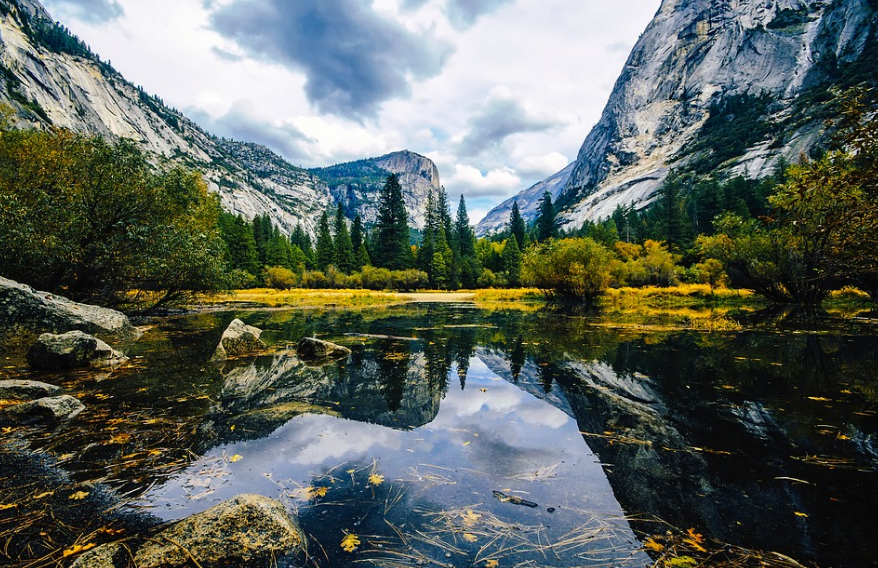
If the thought of hiking 87 miles and climbing 10,850 seems a little daunting to you, then perhaps this more relaxed 13.8-mile hike is more your style. This also gets you only up to 2200 feet. Yet you get fantastic views of the high sierra, and you experience terrific lake camping.
This starts with the Ten Lakes trailhead, which involves a somewhat tiring uphill climb to Ten Lakes pass. That’s followed by a quick descent right to the lake basin.
There’s a short side trail to a view point on the pass that offers an incredible view of the basin along with the Grand Canyon of the Tuolumne just to the north. From this point you can also see an alternate lake you can get to.
If you follow the official trail, you’ll pass by 2 of the largest lakes in the park. Head on towards the earlier lake you saw from the pass, and you’ll spend some time meandering through the basin and along the shores of the lake.
If you’re lucky, you’ll find at the far end of the lake an ideal campsite with a great setup for swimming. Here you can also relax a bit, especially if you put up a hammock. Hopefully you’re with friends and someone brought a cooler with cans of beer, so that you can relax in the sun with a few drinks.
Wake up early the next morning if you can, and hopefully you don’t have a hangover. You can then quickly get to the ridgeline, and you’ll see a most incredible sunrise. After that, you can get back up to the top of Ten Lakes pass.
Sunrise Lakes to Clouds Rest
With this trail, you will definitely enjoy panoramic sights that are simply spectacular. These will include Yosemite Valley with Little Yosemite Valley from Clouds Rest. It’s an overnight hike as you can sleep at the picturesque Sunrise Lakes.
This trial has you stating out at Tenaya Lake Trailhead. From this point you can hike straight on the trail to Clouds Rest. But a better option may be to veer off after about 2.7 miles to Sunrise Lakes. You can then hike in segments and you can rest for the night before you start early to get back on the trail.
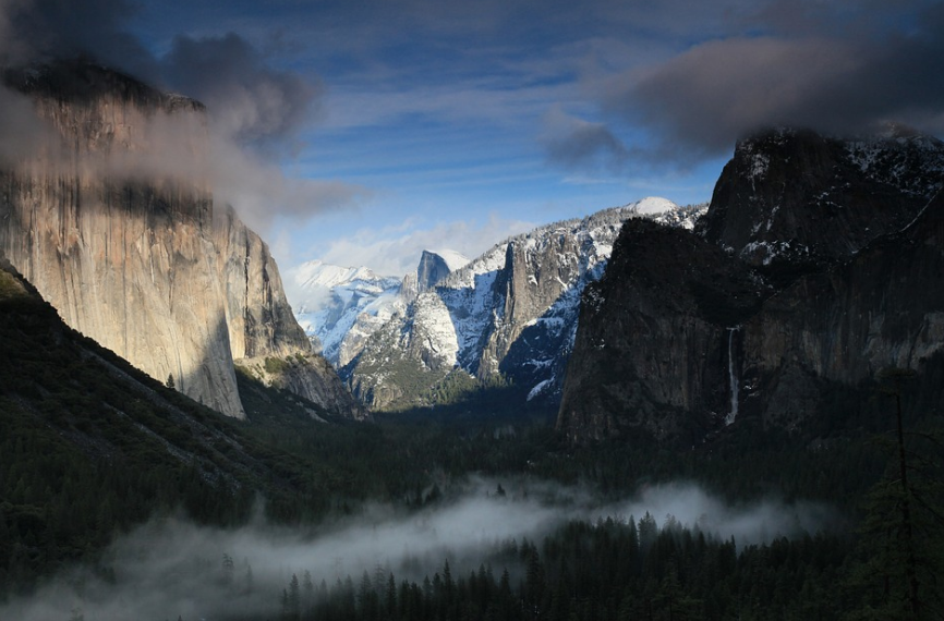
You can then come back to the Clouds Rest trail, where you start with a hike down the slope until you get to the only lake on this trail. You’ll then cross streams and trickles until the trail clears the tree line and the views will be fantastic.
Continue on, and you’ll be climbing up a summit. At the peak, there you’ll find, Little Valley Fire, and the sight of it from this vantage will explain its name. The other side of the view gives you Half Dome, and a view of the valley.
At this point, you can turn back and head on to the Tenaya Lake trail head. That should take about 2 to 3 hours.
Another option is to continue on with your Yosemite hiking, as long as you make sure you have lots of water with you. It’s going to be grueling. You can go on to Little Yosemite Valley, and from there you can either start hiking Half Dome or you can forgo the Yosemite Half Dome hike and stay at Merced Lake.
Conclusion
If you’re going to tackle the best hikes in Yosemite, you better make sure that you visit here so you can make sure your backpack won’t let you down. You better take care of your feet too, so you should take a look at our article regarding the best hiking boots you can use.
If you intend to do a bit of running along the way, consider getting a pair of minimalist trail running shoes. They will certainly come in handy!
You should also make sure you get a Yosemite wilderness permit if you’re backpacking Yosemite. There are quotas for Yosemite backpacking permits, and for the most popular trailheads the quota for reservations can be filled in the first day that Yosemite accepts reservations. Another portion of the permits are available on a first-come, first-served basis, which starts no earlier than 11AM on the day before starting the hike.
